Nature for Climate Change, Peatland Grant Scheme (NfCPGS)
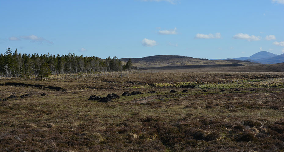
Peatlands are globally important ecosystems that offer us a wide array of valuable services, such as storing carbon, providing clean water, flood alleviation, supporting biodiversity, while alsoproviding historical and recreational benefits. Unfortunately, human activities have caused significant damage to these ecosystems, leading to functional decline. Peatland restoration aims to improve the degraded peatlands' ecohydrological function by using various techniques to change how water flows through them. However, there is still much to learn about the exact processes and rates of recovery after restoration, as well as the understanding the most effective restoration methods.
Building on a decade of research case studies at the University of Exeter (Upstream Thinking 1, Mire-on-the-Moors) this project continues to support and evaluate peatland restoration in collaboration with the South West Peatland Partnership.
This project has multiple exciting threads, each one answering a different question posed by peatland restoration:
Where is there peat in the Southwest of England?
Using remotely sensed data and machine learning we have already mapped the peat extent and depth over the granites of Cornwall and Dartmoor. We will extend this work to map peat extents for the rest of the Southwest. Improving our understanding of peat extents allows these important carbon stores to be better protected.
Which is the best restoration method for large, deep gullies?
The methods used for peatland restoration can have different impacts on the way that water moves through the landscape. To compare the different responses, we are monitoring flow in four large, deep gullies that will each undergo a different restoration technique (leaky dams, stone etc). Following restoration we will assess the impact on lag-times between rainfall and high-water levels and changes to flow within the gully. The outcomes of this study will allow restoration practitioners to make more informed decisions, through better understanding the trade-offs, when undertaking restoration works.
Is there an optimum vegetation cover, area or depth of pool to minimise methane emissions?
Peatland restoration creates pools in order to make the peatland wetter and reduce the speed that water moves through the landscape. Even in a pristine peatland, these pools are sources of methane, a potent? greenhouse gas. Can we minimise methane emissions by controlling the depth or area of the pools created by restoration or promoting certain vegetation covers?
How can we know if peatland restoration is successful when the response can be slow?
Using a space-for-time substitution we are assessing the impact of restoration on vegetation community, water quality, hydrology and greenhouse gas emissions 0, 5, and 10 years following restoration, and contextualising these observations with a nearby “pristine” site. This will build an understanding of what reasonable trajectories and timescales of ecohydrological change are for Dartmoor.
Will restoring the thin peats of Bodmin Moor result in carbon gains?
Using cutting edge technology (LiCOR Li-7810 greenhouse gas analyser, LI-8250 multiplexer and 8200-104C Clear Long-Term Chamber) we are measuring the exchange of carbon dioxide and methane between the atmosphere and four different vegetation communities to quantify their annual carbon balance.
Team members
- Prof Karen Anderson, Professor in Remote Sensing
- Dr Pia Benaud, Research Fellow
- Prof Rich Brazier, Co-Director of CREWW; Professor of Earth Surface Processes
- Dr Naomi Gatis, Research Fellow
- Lou Goodger, Research Technician
Funded by
- Natural England
- Department for Environment, Food & Rural Affairs
- South West Water
- Cornwall County Council
Project Partners
- Bodmin Moor Commons Council
- Cornwall ANOB
- Cornwall Council
- Cornwall Wildlife Trust
- Dartmoor Commoners Council
- Dartmoor National Park Authority
- Devon Wildlife Trust
- Duchy of Cornwall
- Environment Agency
- Exmoor National Park
- The Exmoor Society
- Friends of Dartmoor
- Historic England
- Ministry of Defence
- National Trust
- Natural England
- RSPB
- Southwest Lakes Trust
- University of Plymouth
- Westcountry Rivers Trust
Publications
- Gatis, Naomi, Pia Benaud, Lou Goodger, Richard E Brazier, and Karen Anderson. 2023. ‘St Austell, Bodmin, Carnmenellis and Land’s End Peat Extent and Depth Mapping Report for the South West Peatland Partnership 2023’. University of Exeter.
- Gatis N, Benaud P, Ashe J, Luscombe D, Grand-Clement E, Hartley I, Anderson K, Brazier R (2019). Assessing the impact of peat erosion on growing season CO2 fluxes by comparing peat pans and surrounding vegetated haggs. Wetlands Ecology and Management, 1-19.


