Active Earth

Our Active Earth research group encompasses interdisciplinary exploration into volcanology, geophysics, natural hazards, climate science, and geothermal processes. We address global challenges around: hazard assessment, forecasting, risk, and resilience; climate-hazard interactions; disaster risk reduction, and clean energy supply, amongst others. We collaborate with industry partners, governmental and intergovernmental agencies, other research groups, and observatories to deliver high-impact projects. Our approaches span across disciplines, involving the geosciences, social sciences, data science, engineering, and human and physical geography.
Some current projects
Sakurajima is Japan’s most active volcano, situated on the southern rim of Aira caldera, on the island of Kyushu. Regular small eruptions belie the volcano’s fierce past, including regular Plinian eruptions, the latest of which in 1914 killed 58 people and caused widespread flooding. This ambitious project aims to combine insights from geophysical and geochemical monitoring with those from igneous petrology to unravel the processes dictating eruption size and link them to precursory monitoring signals for improved eruption forecasting. The work is carried out alongside scientists from the Sakurajima Volcano Research Centre, part of the University of Kyoto, and uses a range of multi-disciplinary techniques.
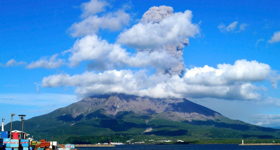
An eruption of Sakurajima volcano, viewed from the nearby city of Kagoshima
Please contact Dr James Hickey for further information
Cornwall and Devon have locally high surface heat flows associated with elevated levels of U, Th and K within the granites of the Cornubian Batholith. It is the most prospective area in the UK for the development of deep geothermal energy. We are working on a number of projects to explore this potential resource, and it forms one of the strategic priorities for Cornwall Council.
Please contact Professor Robin Shail for further information.
How do rocks outburst or release gas? We’re interested in the mechanisms controlling degassing of rocks at a mineralogical scale, and how this could inform hazard mitigation strategies (either underground in a mine, or at surface). For example, lamprophyre dykes represent a serious hazard to mining excavations and developments in some areas of the Bushveld Complex. Falls of ground, catastrophic blow-outs and wall rock failures caused by explosive gas pockets are known to occur. Through our work on the composition and mineralogy of the lamprophyre dykes, we can contribute pragmatic feedback to the mining industry with applied mineralogical advice.
Please contact Dr Hannah Hughes for further information.
DV3M is a NERC-funded project that aims to advance a new generation of dynamic magma mush (DMM) volcano deformation models and resolve the impact of porous magma-mush reservoirs on volcano deformation and reservoir stability. Our model developments will reduce uncertainties in hazard assessment and eruption forecasting for benefit globally at deforming volcanoes, and in particular at our target volcanoes – Soufrière Hills (Montserrat) and Sakurajima (Japan). The work is carried out alongside scientists from the Montserrat Volcano Observatory, Sakurajima Volcano Research Centre, and Universities of Durham, Manchester and Leeds.
Please contact Dr James Hickey for further information.
Volcanic crises can cause significant damage, casualties, and economic loss. Social sensing is the systematic analysis of unsolicited social media data to observe real world events. Through this project we aim to use social sensing to analyse the spatio-temporal social and economic impact of volcanic crises, and the change in emotional response to a crisis as it unfolds, from pre-eruption warnings through to post-eruption recovery. We are exploiting emerging data science and machine learning techniques through collaborations with the Institute for Data Science and Artificial Intelligence, and deploying our approach to case study volcanoes alongside the United States Geological Survey (USGS).
Please contact Dr James Hickey for further information.

As a group we have wide and multi-disciplinary interests in the processes controlling the dynamics of active and restless volcanoes and the geophysical and geochemical signals they produce, with an overarching aim of helping to improve hazard assessment, including climate shock, and eruption forecasting capabilities. We cover the full eruption cycle, from monitoring unrest, through eruption response, to post-eruptive evaluation of potential climate impacts. This work has allowed us to research volcanoes across the globe (e.g., La Palma, Cape Verde, Iceland, Antarctica, South and Central America) and make meaningful contributions to operational volcanological work and the climate science community.
Please contact Dr James Hickey or Dr Thomas Aubry for further information.
Volcanic ash is the most common and widespread hazard from explosive volcanic eruptions, with impacts on human health, infrastructure, and economies. After the onset of an eruption, forecasting ash dispersal rapidly and accurately is crucial to minimise disruptions to air traffic and local populations. This project aims at improving ash forecasting, using information hidden in the sound produced by eruptions. First we are conducting lab experiments, where the sound from miniature eruptions is recorded with high-precision microphones and carefully deciphered. The project also involves a collaboration with the Sakurajima Volcano Observatory (Japan), where the sounds from real eruptions are recorded and analysed, to estimate how much ash is erupted.
Please contact Dr Gilles Seropian for further information.
Volcanic eruptions emit sulphate aerosols into the stratosphere (above 10-16 km altitude) which reflect sunlight and cool the climate. Volcanic cooling is one of the most important natural drivers of climate variability. Constraining past volcanic impacts on climate is thus critical to disentangle natural and anthropogenic factors of climate change since the industrial revolution, as well as evaluating climate models whose projections for future climate are at the heart of climate policies worldwide. In close partnership with international collaborators and climate science bodies such as the Coupled Model Intercomparion Project, we are improving inventories of past volcanic emissions, aerosol models used to estimate their impact on Earth’s energy balance, and in turn climate simulations investigating how climate has evolved over the last hundreds to thousands of years.
Please contact Dr Thomas Aubry for further information.
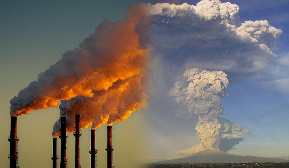
Explosive volcanic eruptions produce columns of ash and gas that can collapse, creating devastating pyroclastic avalanches, or rise tens of kilometres into the atmosphere, dispersing ash hundreds to thousands of kilometres away, which can cause large-scale infrastructure damage, health impacts, and shut down aviation routes. Improving numerical models of eruptive columns is critical to managing these hazards. Our group creates global databases of observations of eruption source parameters (e.g. column height or eruption intensity) and atmospheric conditions (e.g. wind speed and temperature) that we then apply to evaluate and improve these numerical models. We work in close collaboration with British Geological Survey, UK Met Office, and scientists worldwide associated with the Commission of Tephra Hazard Modelling of the international volcanology association (IAVCEI).
Please contact Dr Thomas Aubry for further information.
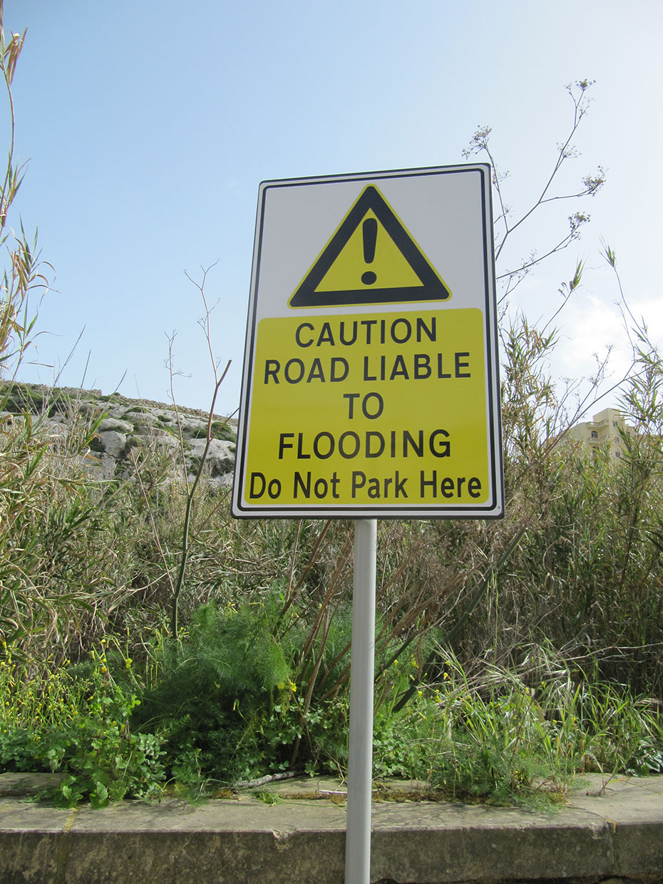
Drawing on interdisciplinary techniques from the social sciences, human and physical geography, research studies in this area explore how natural hazards - including from volcanic eruptions to hurricanes, floods, landslides, sinkholes and more - interact with human society across spatial and temporal scales. Previous work has utilised archival research to produce the first multi-hazard historical catalogue for Malta, corresponding to the Sendai Framework 2015-2030, and extending from the Miocene to 2019; has explored the relationship between natural hazards, tourism, and policy with consideration of vulnerability, resilience, and disaster risk reduction, and has considered flood disadvantage and community-led flood adaptation.
Please contact Dr Geoff Main for further information.
Group members