Ice
Projects
Supervisors: Dr Steven Palmer (email: s.j.palmer@exeter.ac.uk) and Dr Damien Mansell (email: D.T.Mansell@exeter.ac.uk )
Project description
The scientific issue
While significant progress has been made in the assessment of the future contribution to sea level from the major ice sheets of Antarctica & Greenland, less research attention is being given to high latitude ice caps, despite the fact that they will continue to dominate the cryospheric contribution to near-future rates of sea level rise. In particular, projections for the future behaviour of ice caps in the Arctic (outside of Greenland) do not take into account ice dynamic contributions resulting from surge- and tidewater-glacier type cycles and behaviour, because the mechanisms of ice flow variability are not fully understood. This project aims to quantify changes in ice flow at Arctic ice caps to improve our understanding of the processes responsible for variations in flow.
The research
In recent years, the launch of USGS Landsat 8 and the ESA Sentinel satellites have led to a significant improvement in the quality and availability of satellite imagery and radar data. The improved spatial, radiometric and temporal resolution permits more accurate and complete mapping of ice flow variations than has been possible previously. In this project, the student will use Python scripts to extract ice flow measurements from a large database of archived satellite observations in order to detect and quantify flow variations at selected Arctic Ice Caps. They will then use a combination of GIS and python (e.g. ArcPy) to investigate the processes responsible for causing theses variations in flow. Ancillary datasets such as observations of sea-ice extent and outputs from regional climate models will be used to interpret the observations of ice flow. The student needs to have strong GIS background, familiarity with the Python programming language, and a willingness to develop their coding skills.
References
Gardner, A. S., Moholdt, G., Cogley, J. G., Wouters, B., Arendt, A. A., Wahr, J., ... & Ligtenberg, S. R. (2013). A reconciled estimate of glacier contributions to sea level rise: 2003 to 2009. Science, 340(6134), 852-857.
Fahnestock, M., Scambos, T., Moon, T., Gardner, A., Haran, T., & Klinger, M. (2016). Rapid large-area mapping of ice flow using Landsat 8. Remote Sensing of Environment, 185, 84-94.
Supervisor: Dr Anne Le Brocq (email: a.lebrocq@exeter.ac.uk), Dr. Matt Finn and Prof. Justin Dillon.
Project Description
The scientific issue
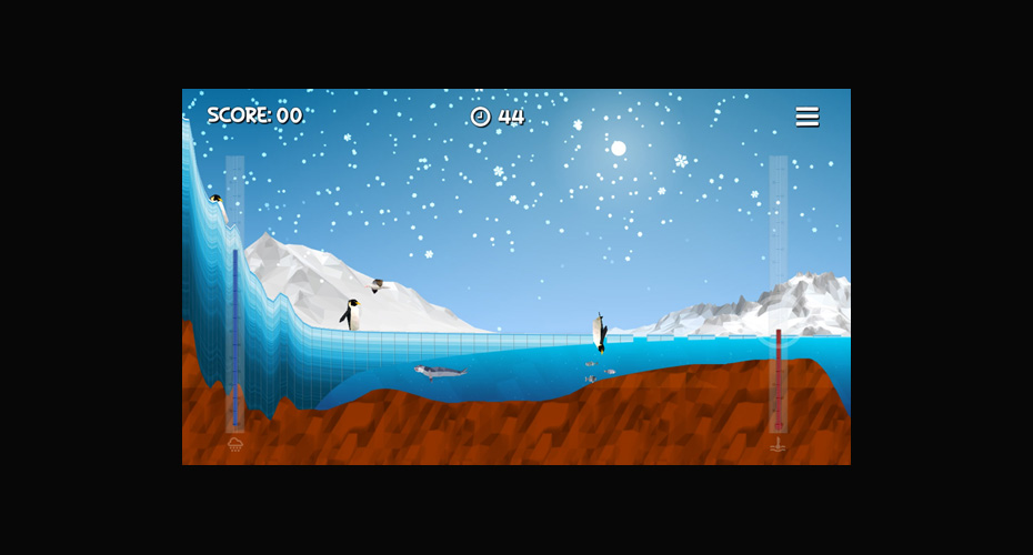
The two major ice sheets, Antarctica and Greenland, have the potential to raise global mean sea level by ~58 m and ~7 m respectively (e.g. Fretwell et al. 2013, Morlighem et al. 2017). The amount of sea level change which will be experienced by the end of the century is highly uncertain, dependent on complex atmospheric, oceanic and glaciological factors. The communication of these complex factors is a major hurdle to wider public understanding of the potential future risks from sea level rise. The computer game, Ice Flows, was developed to help communicate some of these processes in a visual and interactive manner. The game was well received, with tens of thousands of plays, and positive anecdotal feedback. However, the overall impact of the game on learning outcomes has not been quantified, so there is no solid evidence base on which to make further developments to the game and associated resources.
The research
The aim of the project is to assess the impact of playing Ice Flows on the player’s understanding of how ice sheets respond to a changing climate. Further, to assess the player’s level of engagement with the topic and whether the activity leads to any potential change in behaviour. There are now a number of apps and games available for climate change related education, however, empirical assessment of the potential of game-based learning is still fairly limited in the literature (Meya & Eisenack 2018). You will carry out a review of previous studies of the learning outcomes of other apps and games and use this knowledge to devise a programme for assessing the learning impacts of Ice Flows. The research programme can encompass learning outcomes across a range of ages and educational (or not) settings.
References
Fretwell, L.O., et al., Bedmap2: improved ice bed, surface and thickness datasets for Antarctica. The Cryosphere, 2013. 7: p. 375-393.
Meya, J. N., & Eisenack, K. (2018). Effectiveness of gaming for communicating and teaching climate change. Climatic change, 149, 319-333. doi.org/10.1007/s10584-018-2254-7.
Morlighem, M., Williams, C. N., Rignot, E., An, L., Arndt, J. E., Bamber, J. L., … Zinglersen, K. B. (2017). BedMachine v3: Complete Bed Topography and Ocean Bathymetry Mapping of Greenland From Multibeam Echo Sounding Combined With Mass Conservation. Geophysical Research Letters, 44(21), 11,11-51,61. https://doi.org/10.1002/2017GL074954


