Postcode eligibility checker
If you are thinking of applying for Exeter Scholars or Community Exe but are not sure if your postcode will be eligible, then use the postcode checkers below to find out.
NB: These postcode checkers are for England only. If you live outside England and wish to check your postcode eligibility, please contact us.
Low-participation neighbourhood
Check whether you live in a low-participation neighbourhood
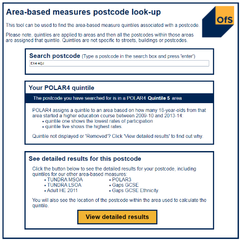
Access the postcode checker.
Type your postcode and press enter.
In order for your postcode to be eligible, it needs to be a POLAR4 Quintile 1 or Quintile 2 area.
If your postcode is POLAR4 Quintile 3, Quintile 4, or Quintile 5, it is not eligible on this criteria.
Low-income neighbourhood
Check whether you live in a low-income neighbourhood
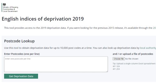
Access the postcode checker.
Enter your postcode and click 'Get Deprivation Data'.
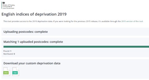
The website will produce an Excel document. Please click the light green 'xlsx' icon under 'Download your custom deprivation data', and the Excel document will download.
When you open the spreadsheet, you will see a range of columns. Look in column F. This column should be titled 'Index of Multiple Deprivation Decile', and the information in the column should be a number between 1 and 10.
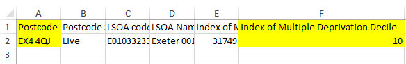
In order for your postcode to be eligible, this number needs to be 1, 2, 3, or 4.
If your postcode is a 5, 6, 7, 8, 9, or 10, it is not eligible on this criteria.
NB: Deprivation data comes from the government. It is used to compare relative deprivation rates between neighbourhoods, and not to label a particular postcode or its residents as being deprived. The categories created – referred to as deciles – take into account a wide range of information about different postcode areas, including household income, employment rates, access to education, skills, and training, health and disability, crime, barriers to housing services, and living environment.